Event 002 - Two-Camera Detection / Triangulation Test
05 Oct 2026 | 20:35-20:36 local MC time | Engineering test
Bottom line
Mission Control produced triangulation TARGET solutions, but the solutions are not physically consistent with the contemporaneous ADS-B aircraft candidate. This demonstrates execution of the triangulation path, not validated triangulation accuracy. A faint moving point is visible in both recorded camera streams. No Interceptor handoff is established.
Source imagery
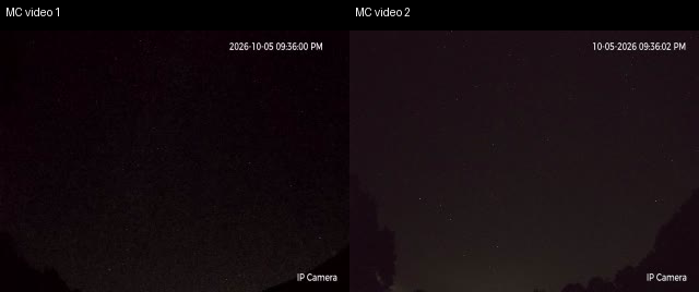
Unaltered source frames. The target is extremely small at 320x240 recording resolution.
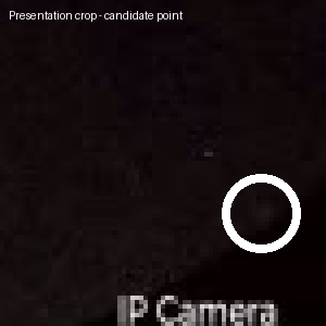 Presentation enlargement only; white circle added.
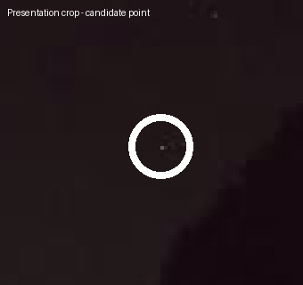 Presentation enlargement only; white circle added.
Mission Control triangulation output
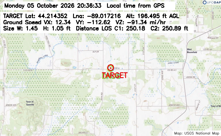 20:36:33: 44.214352, -89.017216; 196.495 ft AGL; LOS C1 250.18 m, C2 250.89 m.
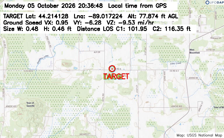 20:36:48: 44.214128, -89.017224; 77.874 ft AGL; LOS C1 101.95 m, C2 116.35 m.
Geometry check
Tower A and Tower B Cam 1 are only about 18.8 m apart. The displayed solutions are near-field: about 102-251 m line of sight and 24-60 m AGL.
The aircraft file logged SKW4609 at 20:35:55; last position/contact 20:35:48 at 44.30, -88.88, geometric altitude 4,945.38 m, velocity 170.91 m/s, true track 292.47 degrees and vertical rate +20.81 m/s. That position is about 14.5 km horizontally from Tower A. These geometries are incompatible. SKW4609 is a plausible conventional candidate to investigate, but is not proven to be the optical point and cannot be the displayed near-field triangulated solution.
Handoff
No Scout-to-Interceptor handoff is established. Correct finding: handoff not demonstrated, not "handoff failed."
Timestamp observation
MC map frames show about 20:36 local time from GPS while camera overlays show about 21:36. This reproduces an apparent one-hour difference in recorded output. Prior live-panel checks showed synchronized clocks, so the recording/overlay time path remains unresolved.
Auxiliary data
Weather was calculated at 19:10, about 85 minutes earlier: clear sky, 11.19 C, 71% humidity. MSDAU remained Triggered=False and EM Field was 0.0. RF spectrum was recorded; no RF-to-optical association is established.
Final classification
Next controlled test
Use a known ADS-B aircraft. Preserve each OTDAU local video and reported azimuth/elevation history, synchronized MC map video and ADS-B track. Compare each sight line against the known aircraft geometry before accepting the intersection. A substantially larger station baseline should improve distant-aircraft geometry.
Evidence downloads
MC map | Video 1 | Video 2 | Aircraft | MSDAU | Weather | RF
Preserve first. Interpret second. Conclude last. No generated imagery is used as event evidence.